Future of Himalayan Pilgrimage: Navigating Glacier Floods & Evolving Risks
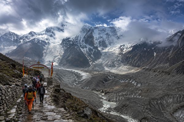 A path to devotion, forever changed: The future of Himalayan pilgrimages faces critical environmental shifts.This image depicts a pilgrimage path, altered by environmental shifts, for illustrative purposes.
Ram Singh stood near the Kedarnath temple courtyard, the crisp mountain air usually a balm to his soul, but this time, a sense of unease gnawed at him. He heard the “loudest crack” of his life, described as the deafening roar of a disaster, and felt as if the sky had been torn apart [3]. Within seconds, a massive wall of water gushed towards Kedarnath Temple, with huge boulders flung into the sky; in less than 15 minutes, thousands of people were swept away [3]. That was 2013: a stark, visceral lesson in the Himalayas' raw, unpredictable power, and one that has become even more urgent as the climate shifts.
The allure of Himalayan pilgrimage remains undimmed, drawing millions seeking spiritual solace amidst towering peaks. Yet the landscape through which this timeless journey unfolds is changing, shaped by forces both natural and man-made. The glaciers that have sculpted these revered mountains for millennia are shrinking at an alarming rate, creating new and intensifying hazards. Understanding these evolving dangers, from sudden glacial lake outburst floods to the subtle, cumulative effects of unchecked development, is no longer merely an academic exercise. It is a critical prerequisite for safeguarding both pilgrims and the sacred mountains themselves.
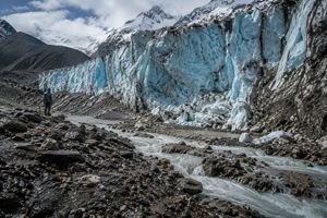 The stark reality: Himalayan glaciers retreat, leaving behind a volatile landscape of meltwater and unstable debris.This image illustrates the effects of glacier retreat on the Himalayan landscape.
The Shrinking Giants: When Mountains Weep Rivers of Risk
Across the Garhwal Himalayas, glaciers feeding the Char Dham towns are shrinking rapidly, with the study documenting significant retreat across the Gangotri, Yamunotri, Badrinath, and Kedarnath glacier systems [1]. It is a silent, relentless transformation, with every meter of ice lost marking another shift in a warming landscape. The numbers are chilling: Gangotri, a primary feeder for one of India's holiest rivers, recedes at a staggering 22.3 meters per year. Yamunotri follows at 20 meters per year, Badrinath at 17.3 meters per year, and Kedarnath at 14.1 meters per year, according to the study’s assessment of glacier retreat across the four Char Dham pilgrimage circuits [1]. Satellite data also shows a consistent rise in temperatures across all seasons from 1990 to 2020, with the steepest increases recorded during the pre-monsoon and monsoon months [1].
Chorabari illustrates why glacier retreat is not simply a story of accelerating melt. Its thick debris cover acts as an insulating layer, slowing the glacier's melting [4]. Yet retreating glaciers also leave behind vast quantities of loose debris that can become unstable and slide downslope during heavy rainfall or rapid snowmelt, triggering landslides or rapid debris flows [5]. The result is a precarious balance in which one factor may slow ice loss while the changing landscape creates new forms of instability.
That growing instability matters downstream, where settlements and pilgrimage routes occupy the path of these changing mountain processes. Over 60.6% of Gangotri's landscape lies above 4,200 meters, leaving human settlements and pilgrimage routes downstream exposed to heightened vulnerability [1]. Similar steep gradients characterize the sacred corridors of Kedarnath and Badrinath, where fragile moraines and active seismicity contribute to increased exposure [1]. Manish Mehta, a senior scientist at the Wadia Institute of Himalayan Geology, observed, "In the case of Chorabari, the rate of retreat would have been significantly higher if not for the thick debris cover, which acts as an insulating layer, slowing down the glacier's melting" [4]. His observation underscores the complex interplay of forces in the region, where a factor that mitigates one hazard can coexist with conditions that heighten another.
Secure Your Ascent: Adapt & Anticipate
Pilgrimage operators and local authorities must establish dynamically updated safety perimeters around high-altitude staging grounds. Tourism planning should incorporate real-time visitor monitoring and advanced weather radars to better manage hazards along the pilgrimage corridors [1].
The Deluge Unleashed: Cracking the Code of Catastrophic Glacier Floods
The consequences of a changing glacial landscape can be sudden and devastating. On June 17, 2013, Chorabari Tal breached its right lateral moraine barrier, with the study assuming that the breach was initiated by accumulated rainwater overtopping the moraine ridge [6]. The lake lay at 3,845 meters above sea level, with a 291-hectare catchment, and the study estimated that at least 149 millimeters of rainfall would have been required to fill it, excluding antecedent water and losses through seepage and evaporation [6]. At the point of breaching, Chorabari Tal released 0.43 million cubic meters of water, with a peak discharge estimated at 1,352 cubic meters per second [6]. The study found that 44.2% of Kedarnath’s pre-event building roof area was obliterated, while another 26.7% was partly damaged [6].
Such events exist within a broader high-altitude environment shaped by glacial melt, strong solar radiation, and monsoon conditions. A study examining cloudburst events in the Garhwal-Kumaon Himalaya considers the possible relationship between these factors and high-altitude glacial lakes [2]. Uttarakhand has 118 high-altitude glacial lakes covering 231 hectares, according to the National Wetland Atlas cited by the study [2]. The analysis suggests that strong solar radiation at high altitudes increases evaporation from these lakes, increasing the depth and volume of clouds, which can collapse in different parts of the Garhwal-Kumaon region as cloudbursts [2]. The paper presents this as a hypothetical analysis based on secondary data, examining the possible relationship between high-altitude lakes, glacier melt, and cloudburst events [2].
Another, less visible factor can further intensify glacier warming: black carbon. Soot from vehicular exhaust and biomass burning settles onto snow and ice, reducing albedo and causing greater absorption of solar heat [7]. Anil Kulkarni, a distinguished visiting scientist at the Divecha Center for Climate Change, Indian Institute of Science, warns, "Black carbon deposits in the glaciers also leads to reduced albedo which causes more absorption of heat... Reducing albedo is an irreversible process and hence darkening of high mountain is taking place. Our assessment is that after mid-century the contribution of glaciers to river flow will reduce significantly" [7]. This darkening makes the glaciers more efficient solar absorbers, accelerating their decline and potentially increasing vulnerability to glacial lake outburst floods.
Forecasting Fury: Install & Alert
Disaster management agencies must install automated water-level sensors and early warning sirens at all potentially dangerous glacial lakes. These measures should be complemented by advanced weather radars and real-time visitor monitoring to strengthen hazard detection and response along the pilgrimage corridors [1].
The Unstable Foundations: When Development Outpaces Discernment
Glacial hazards are only part of the equation. Manveer Panwar, a 30-year-old trekking guide in Bhatwari, points to fresh cracks snaking across the soil after every monsoon. “No one cares until something big like Joshimath happens,” he said, as locals expressed concern over road widening involving heavy machinery and blasting [9]. His observation reflects a deeper vulnerability: the Himalayas are the youngest mountain chain and remain geologically active. Bhatwari lies within the Main Central Thrust (MCT) zone, where highly jointed gneissic and schistose rocks occur alongside loose sediments and giant boulders indicating a palaeo-slide [9].
The All Weather Road highway project is increasing landslide risks along the Uttarkashi–Bhatwari stretch, with experts attributing the recent increase in landslides directly to road widening and related deforestation of the slopes [9]. More than 25,000 trees have reportedly been felled to make way for the project, raising serious environmental concerns in the ecologically sensitive region [10]. The issue is therefore more than aesthetic: changes to vegetation and mountain slopes can become part of a broader structural vulnerability.
Road widening and excavation on vulnerable mountain slopes can contribute to instability, while increased pore-water pressure from glacial melting and erratic heavy rainfall can further disturb loose glacial and fluvial deposits and landslide debris [9]. The Wire's report on Himalayan disasters cites the 2023 Silkyara tunnel collapse as an example in which an inadequate geological survey, faulty design, and improper aquifer mapping were identified as contributing concerns [11]. Towns including Bhatwari and Karnaprayag have also been facing land subsidence, with the article linking the problems to factors including slope instability, road widening, excavation, over-construction, and inadequate drainage [9]. During the monsoon, unsystematic flushing of rainwater can weaken the foundations of houses in Karnaprayag, further illustrating the consequences of poor drainage [9]. Ravi Chopra, chairperson of the Supreme Court-appointed high-powered committee, lamented, "hill cutting and destruction of forests are now in full swing in all ongoing projects in gross violation of the SC's order" [12]. Together, these examples show how poorly planned interventions can compound the effects of natural mountain processes.
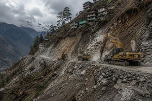 Progress or peril? Unchecked infrastructure development destabilizes fragile Himalayan slopes.This image illustrates the impact of infrastructure development on mountain stability.
Build with Wisdom: Prioritize Stability
Infrastructure developers must account for the heightened vulnerability of mountain slopes during the monsoon, when rainwater can contribute to slope instability and weaken foundations in affected areas [9].
The Pilgrim Paradox: Overcrowding & The Illusion of Safety
Environmental vulnerability becomes even more consequential when millions of people converge on fragile mountain corridors. Annual visitor counts to the Char Dham pilgrimage routes exploded from a manageable 1 million in the early 2000s to more than 3 million in 2022 [1]. These numbers far exceed the estimated daily carrying capacities: Badrinath at 15,778 visitors, Kedarnath at 13,111, Gangotri at 8,178, and Yamunotri at 6,160 [1]. During peak yatra months, visitor numbers routinely exceed these estimated daily limits [1]. The result is a logistical vulnerability waiting for an environmental trigger.
Beyond the sheer numbers, however, another layer of risk is psychological. Research using Interpretative Phenomenological Analysis found that collective prayers, chants, and shared rituals can foster a sense of security and mutual support among pilgrims while reducing their perceived risk [13]. This psychological state creates a powerful sense of "collective reassurance" among devotees [13]. Consequently, faith, spiritual rewards, community norms, and traditions can reduce pilgrims’ risk perception, with some participants relying more on faith than on weather warnings or insurance [13]. Faith may be profoundly personal, but in a group setting it can also shape how pilgrims interpret and respond to danger.
Modern pilgrimage introduces another dimension: conveniences that can bypass some of the traditional rigors of the journey. The Wire notes that multiple helicopter flights now operate daily to the Dhams, raising questions about their ecological and spiritual implications [11]. At the same time, technology can strengthen preparedness. "An integrated early warning system can alert the public about any impending disaster," says Kalachand Sain, director at Wadia Institute of Himalayan Geology [8]. The technology exists; the greater challenge is ensuring that warnings are received and heeded by a population caught between spiritual fervor and practical peril.
Mindful Movement: Regulate & Educate
Tourism authorities should implement real-time visitor monitoring and manage visitor numbers in line with the estimated daily carrying capacities of the Char Dham pilgrimage sites [1]. Scientists have also recommended installing more seismometers in vulnerable areas and monitoring the data they provide to help prevent loss of life and property in future disasters [8].
Forging a Future: Sustainable Tech & Policy Frameworks for Safe Journeys
The challenges facing Himalayan pilgrimage are monumental, but potential solutions are emerging at the intersection of technology, sustainable policy, and a renewed respect for these sacred mountains. Advanced weather radars and real-time visitor monitoring can strengthen preparedness and improve risk management along the pilgrimage corridors [1]. These are more than technological upgrades; they can provide the information needed to respond before rapidly changing conditions become disasters.
Policy, too, plays a pivotal role. The Wire notes that the recommendations of the Bhagirathi Eco-sensitive Zone, established in 2012, were ignored [11]. The study also recommends prioritising electric or BSVI vehicles along the pilgrimage corridors as part of measures to reduce the environmental impact of pilgrimage [1]. The environmental footprint of pilgrimage is therefore not limited to foot traffic: vehicular emissions can also play a critical, often underestimated, role in glacier degradation.
Perhaps most importantly, Himalayan disasters rarely result from a single cause. They can emerge from multiple interacting factors that amplify one another [5]. Glacial retreat, shifting rainfall and snowfall patterns, extreme precipitation, rising nighttime temperatures, loose glacial debris, and steep mountain slopes can combine to intensify the severity of disasters across the Himalayas [5]. Manish Mehta explains that rising temperatures are causing many Himalayan glaciers to steadily recede, a phenomenon known as “glacial retreat,” while retreating glaciers leave behind vast quantities of loose debris [5]. These interconnected vulnerabilities mean that addressing one hazard in isolation may leave the wider system exposed.
The future of Himalayan pilgrimage therefore demands a paradigm shift: from passive veneration to active stewardship. Regional authorities must strengthen real-time visitor monitoring, deploy advanced weather radars, promote satellite eco-routes to decentralise tourism, and prioritise electric or BSVI vehicles along the pilgrimage corridors. Together, these measures are intended to address the environmental and safety challenges associated with rapid glacier retreat, rising temperatures, and growing visitor pressure across the Char Dham routes [1]. Protecting the future of pilgrimage ultimately means protecting the fragile landscape that makes the journey possible.
Chart a New Course: Integrate & Electrify
The study recommends implementing real-time visitor monitoring and deploying advanced weather radars to strengthen preparedness and risk management along the Char Dham pilgrimage corridors [1].
Travel to the Himalayas: Your Essential Questions Answered
What is a Glacial Lake Outburst Flood (GLOF) in the Himalayas?
How do high visitor numbers increase flood risks along Char Dham routes?
How does black carbon accelerate Himalayan glacier retreat?
What carrying capacity limits are recommended for Char Dham shrines?
Why does collective pilgrim behavior lower personal disaster risk perception?
Disclaimer: This article discusses travel-related topics for informational purposes only. Travel conditions, costs, and availability are subject to change without notice. Images are illustrative and may not reflect current or exact locations. For further details, please see our full disclaimer.